

Metropolis Excavations in Izmir/Torbali
METROPOLIS, Torbali, Izmir
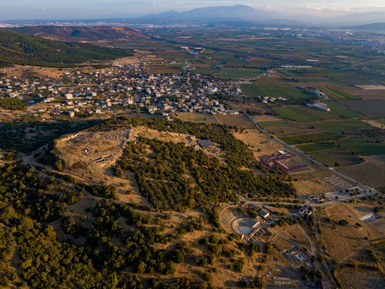
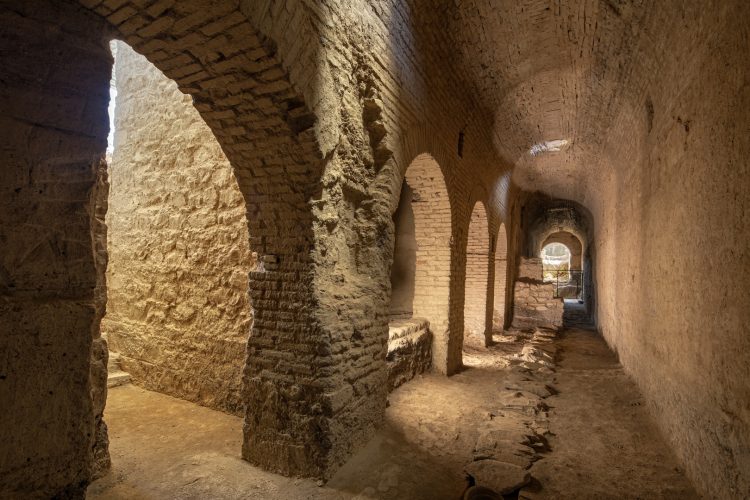
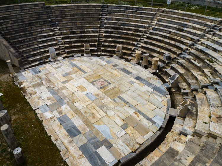
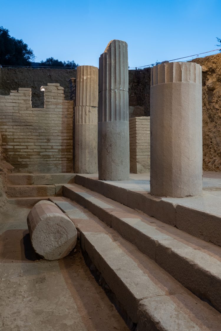
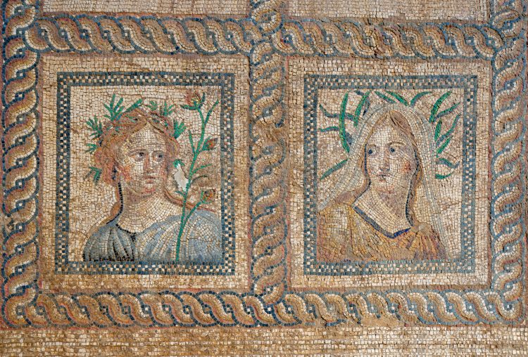
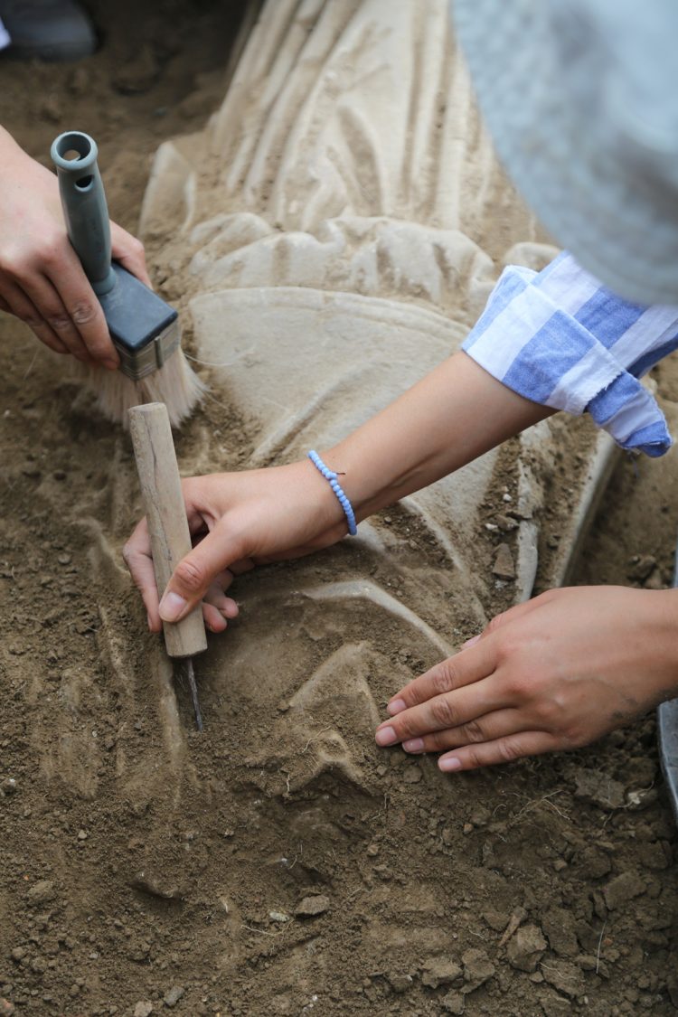
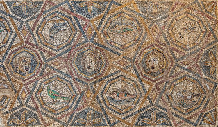
Archaeological Researches in the Ancient City of Metropolis, located between Yeniköy and Özbey Neighborhoods of Torbalı District of İzmir Province, are carried out on behalf of the Ministry of Culture and Tourism and Dokuz Eylül University with the Presidential Decree dated 3/7/2023 and numbered 7336. The first scientific excavations in Metropolis were initiated in 1990 by Prof. Dr. Recep Meriç, one of the founders of the Department of Archaeology, and have been carried out by a team headed by Prof. Dr. Serdar Aybek since 2007. The “Metropolis Archaeology Project”, in which many academicians, especially many faculty members of the Department of Archaeology, have taken part so far, continues to offer students and researchers the opportunity to work with the richness of culture that continues from prehistoric times to the present day. Metropolis, which is 36 km away from DEU Tınaztepe Campus, can be reached by car using the Izmir-Aydın Highway or by using Yeniköy Minibuses from Tepeköy Arrival Stop of İZBAN departing from Izmir. The city was founded on a hill and slopes with an altitude of 142 m, overlooking the Torbalı Plain. This point was also chosen as the acropolis of the city. Metropolis, together with the prehistoric settlements around it, is at the intersection of important roads that have not changed for about 5000 years. Its strategically important location is directly related to the geographical structure of the Torbalı Plain. Founded at the western end of the Küçük Menderes (Kaystros) Basin between the Bozdağ Mountains (Tmolos) and Aydın Mountains (Messogis), the city has fertile agricultural lands with its location dominating the plain. In addition, it is located in the middle of the trade route connecting two important metropolises, Ephesos to the south and Smyrna to the north. The pioneering settlements around Metropolis show that the strategic importance of the region has been understood since prehistoric times. Dedecik-Heybelitepe Mound, 2 km. south of the city, is one of the earliest settlements of the region, founded in the Late Neolithic-Early Chalcolithic Age. 7 km. to the north, the settlement of Badegedigi Tepe (Puranda?) has a similar strategic position to Metropolis. It survived from the Early Bronze Age to the Late Geometric Period. Today’s Torbalı Plain, which forms the plains of Metropolis, is the intersection point of two important roads. These highways, which have maintained their importance from ancient times to the present day, had a direct impact on Metropolis becoming a rich city. Strabo did not specify the exact region of the city, but he mentioned that there was a settlement between Smyrna and Ephesus, 120 stadia from Ephesus. On the other hand, the Ionian legend seen on the city coins allows Metropolis to be identified as an Ionian city. It is accepted that the name Metropolis means “City of the Mother Goddess”. It is possible to identify finds from the Early Bronze Age to the Middle Ages in Metropolis. The acropolis, surrounded by a strong city wall, was built in the 3rd century BC in accordance with the modern urbanism of the period. The eastern gate in the acropolis walls opens to the settlement planned on the eastern slopes of the hill, defined as the lower city, while the western gate provides access to the necropolis area. The city prospered in the 2nd century BC with the support of the Kingdom of Pergamon. The best examples of this level of prosperity are the official buildings planned in public areas such as Theater, Stoa, Bouleuterion. With the Roman rule in Anatolia, the city, which was always on the side of Pergamon and Rome, continued to grow under Augustus and Tiberius. It is possible to understand from the repairs and new architectural arrangements in some buildings that Metropolis was also damaged by the 17 AD earthquake that shook Western Anatolia. In addition, new civilian settlements, bath complexes and shops were built according to the needs of the growing population in the city, and many old buildings were repaired and reopened for service. In the 2nd century AD, Metropolis has the identity of a planned city with its sanctuaries, public buildings, civilian residences, streets and avenues that cut each other perpendicularly despite being a city built on a hillside. The fact that a large Bath and Palaestra complex was built in Metropolis during the reign of Antoninus Pius, who contributed to many cities in Western Anatolia, is an indication of the level of prosperity the city reached. The 3rd century AD was a century of many severe earthquakes and Gothic raids, which put a great strain on the cities of the region. Between the 4th-6th centuries AD, it is understood that architectural construction activities with smaller budgets continued in the city. In addition, it is observed that works such as repair, renovation and change of function were carried out in the existing buildings. It is known that Metropolis was a bishopric center in the 6th century AD. The Byzantine Church at Araplıtepe Mevkii, which underwent changes in different periods, must have been used as an episco pal church from the 6th century AD. The growing strength of the Turkish principalities in Anatolia made it necessary for the Byzantines to attach importance to defense structures. The Byzantine Fortress built in Metropolis, whose strategic position once again came to the fore, was built or extensively repaired during the Laskarids Period (1204-1261). Ottoman sources mention the existence of a castle named Kızılhisar, which must have been near Torbalı. Metropolis Castle seems to fit this description. The Byzantine castle was used for a short period of time during the Ottoman period, and after the Ottoman Empire took complete control of the region, the settlement was moved to the area on the plain where Torbalı is located today.
For more information, see Web: https://metropolistr.org